
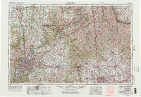
1956 Map of Louisville
USGS Topo · Published 1971About this map
Louisville serves as the focal point for this mid-century regional study, showcasing the city's suburban expansion into communities like St Matthews, Shively, and Okolona. The winding course of the Ohio River dictates the landscape, separating the industrial centers of Kentucky from Indiana towns such as Jeffersonville and New Albany. A dense network of transportation infrastructure is evident, with the Louisville and Nashville RR and the Baltimore and Ohio RR converging on the river's banks, while the Jefferson Proving Ground and Fort Knox Military Reservation mark significant federal land use in the post-war years. Beyond the urban core, the map captures the transition to the Bluegrass region, following the Kentucky River through Frankfort and tracing the prominent limestone ridges of Cane Ridge and Pine Ridge. This edition preserves the relationship between the river-and-rail economy and the outlying agricultural towns of Shelbyville and Eminence before modern interstate development reshaped the corridors.
Find a feature on this map
87 named features on this map. Tap any name to fly to it.
Don’t see what you’re looking for? This feature index may not catch every label — zoom into the map to look around manually.
Map Details
Editions of this 1956 Louisville Map
2 editions found
Other maps of this area

1892 · Richmond
USGS Topo · 1:125,000

1892 · Beattyville
USGS Topo · 1:125,000

1897 · Richmond
USGS Topo · 1:125,000

1898 · East Cincinnati
USGS Topo · 1:62,500

1905 · Harrodsburg
USGS Topo · 1:125,000

1905 · Prospect
USGS Topo · 1:62,500

1906 · Lockport
USGS Topo · 1:48,000

1906 · Georgetown
USGS Topo · 1:62,500

1907 · Louisville
USGS Topo · 1:62,500

1908 · Lockport
USGS Topo · 1:62,500