
1959 Map of San Jacinto
USGS Topo · Published 1960About this map
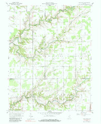
Jefferson Proving Ground U S Military Reservation dominates this landscape, covering substantial portions of Ripley, Jennings, and Jefferson counties during the late 1950s. The map illustrates a strictly organized grid of internal military roads, such as H Road and G Road, which contrast sharply with the natural, winding paths of Big Graham Creek and its tributaries. Outside the reservation boundaries, the small settlement of San Jacinto sits near the western edge, surrounded by timbered ravines and scattered farmsteads. Genealogists may find interest in the location of Bethel Cem tucked away near Rush Branch in the northwest. The terrain is characterized by deeply incised creek beds like Lancaster Creek and Little Graham Creek, which define the topography of Shelby and Monroe townships.
Find a feature on this map
23 named features on this map. Tap any name to fly to it.
Don’t see what you’re looking for? This feature index may not catch every label — zoom into the map to look around manually.
Map Details
Editions of this 1959 San Jacinto Map
4 editions found
Other maps of this area

1942 · Columbus
USGS Topo · 1:125,000

1946 · Versailles
USGS Topo · 1:24,000

1953 · Cincinnati
USGS Topo · 1:250,000

1956 · Volga
USGS Topo · 1:24,000

1956 · Clifty Falls
USGS Topo · 1:24,000

1956 · Canaan
USGS Topo · 1:24,000

1956 · Louisville
USGS Topo · 1:250,000

1957 · Cincinnati
USGS Topo · 1:250,000

1957 · Butlerville
USGS Topo · 1:24,000

1959 · Holton
USGS Topo · 1:24,000