
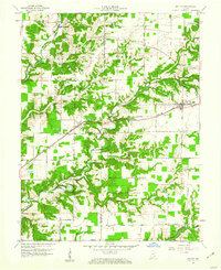
1959 Map of Holton
USGS Topo · Published 1960About this map
The Jefferson Proving Ground dominates the southern landscape of this mid-century survey, illustrating the significant military presence within the Jennings and Ripley county borderlands. The map details a transition from the structured grid of the U S Military Reservation, featuring restricted routes like North East Road and Permiter Road, to the rural agricultural communities of Holton and Nebraska. Historically significant sites for genealogists include St Bridget Cem and Old Hopewell Cem, alongside the Muscatatuck State School in the west.
Find a feature on this map
43 named features on this map. Tap any name to fly to it.
Don’t see what you’re looking for? This feature index may not catch every label — zoom into the map to look around manually.
Map Details
Editions of this 1959 Holton Map
4 editions found
Other maps of this area

1942 · Columbus
USGS Topo · 1:125,000

1946 · Versailles
USGS Topo · 1:24,000

1946 · Osgood
USGS Topo · 1:24,000

1953 · Cincinnati
USGS Topo · 1:250,000

1956 · Louisville
USGS Topo · 1:250,000

1957 · Cincinnati
USGS Topo · 1:250,000

1957 · Butlerville
USGS Topo · 1:24,000

1958 · Millhousen
USGS Topo · 1:24,000

1958 · Westport
USGS Topo · 1:24,000

1959 · San Jacinto
USGS Topo · 1:24,000