2022 Map of Vesper
USGS Topo · Published 2022About this map
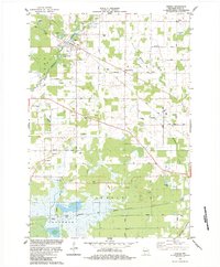
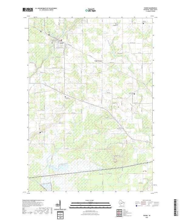
Vesper serves as the primary hub of this central Wisconsin landscape, situated where Hemlock Creek and its eastern fork wind through the countryside. The area's cultural history is deeply rooted in its religious sites, evidenced by a dense collection of burial grounds including Faith Reformed Church Cem and Saint James Cem near the village center. The survey captures a patchwork of agricultural plots and wetlands, particularly noticeable in the south where Cranberry Cr flows. To the east, the small settlement of Eight Corners and the private Winch Airfield show the continued utility of the land for local transportation and aviation. Genealogists will find the map particularly useful for identifying parish affiliations, as seen with Saint Pauls Lutheran Cem and Saint Josephs Cem, which are spread across the rural sections of the t23n r4e and t23n r5e townships.
Find a feature on this map
87 named features on this map. Tap any name to fly to it.
Don’t see what you’re looking for? This feature index may not catch every label — zoom into the map to look around manually.
Map Details
Editions of this 2022 Vesper Map
This is the sole edition of this map. No revisions or reprints were ever made.