2024 Map of Viola
USGS Topo · Published 2024About this map
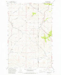
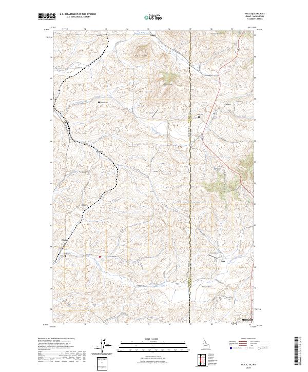
The Palouse Range defines the eastern terrain of this landscape where the high rolling hills of Latah County meet the Washington state line. The community of Viola sits at the intersection of Loess Rd and Four Mile Rd, serving as a central point for the surrounding agricultural tracts. This 2024 survey documents a network of rural settlements and family landmarks, including Coleman Cem, Viola Cem, and Whelan Cem. Waterways like Fourmile Creek and Missouri Flat Creek cut through the topography, which is punctuated by prominent heights such as Angel Butte and Randall Butte. Local aviation is represented by Hill Airport and Estes Airport, while the southern edge of the map begins to reveal the outskirts of Moscow. The survey captures the intricate secondary road system, from Beeson Cutoff to Pullman Airport Rd, that connects isolated homesteads and small localities like Estes and Fallon.
Find a feature on this map
65 named features on this map. Tap any name to fly to it.
Don’t see what you’re looking for? This feature index may not catch every label — zoom into the map to look around manually.
Map Details
Editions of this 2024 Viola Map
This is the sole edition of this map. No revisions or reprints were ever made.