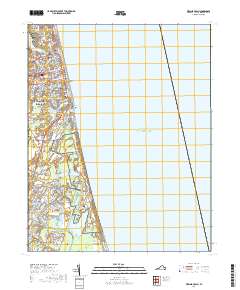
2019 Map of Virginia Beach
USGS Topo · Published 2019About this map
Virginia Beach and its surrounding coastal neighborhoods are mapped here at the height of the modern era, showing the dense grid of the resort area alongside extensive protected wetlands and military landscapes. The map detail highlights the geographic transition from the busy corridors of Pacific Ave and Atlantic Ave to the more secluded residential pockets of North Linkhorn Park and Bird Neck Point.
Find a feature on this map
122 named features on this map. Tap any name to fly to it.
Don’t see what you’re looking for? This feature index may not catch every label — zoom into the map to look around manually.
Map Details
Editions of this 2019 Virginia Beach Map
This is the sole edition of this map. No revisions or reprints were ever made.
Other maps of this area

1893 · Virginia Beach
USGS Topo · 1:125,000

1907 · Norfolk
USGS Topo · 1:125,000

1916 · Back Bay
USGS Topo · 1:62,500

1918 · Cape Henry
USGS Topo · 1:62,500

1919 · Cape Henry
USGS Topo · 1:62,500

1939 · Moyock
USGS Topo · 1:62,500

1943 · Back Bay
USGS Topo · 1:62,500

1946 · Moyock
USGS Topo · 1:62,500

1946 · Eastville
USGS Topo · 1:250,000

1946 · Currituck Sound
USGS Topo · 1:250,000