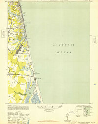
1948 Map of Virginia Beach
USGS Topo · Published 1948About this map
Virginia Beach is depicted during a transformative era of coastal development and military expansion. The map reveals a dense corridor of coastal settlement served by the Norfolk Southern railroad, with established stops at Casino Station and Lake Station. Landmarks like The Casino and the Princess Anne Club Golf Links emphasize the area's growth as a destination, while the presence of Camp Pendleton and Dam Neck underscores the heavy military footprint along the coast in the late 1940s.
Find a feature on this map
37 named features on this map. Tap any name to fly to it.
Don’t see what you’re looking for? This feature index may not catch every label — zoom into the map to look around manually.
Map Details
Editions of this 1948 Virginia Beach Map
This is the sole edition of this map. No revisions or reprints were ever made.
Other maps of this area

1893 · Virginia Beach
USGS Topo · 1:125,000

1907 · Norfolk
USGS Topo · 1:125,000

1916 · Back Bay
USGS Topo · 1:62,500

1918 · Cape Henry
USGS Topo · 1:62,500

1919 · Cape Henry
USGS Topo · 1:62,500

1939 · Moyock
USGS Topo · 1:62,500

1943 · Back Bay
USGS Topo · 1:62,500

1946 · Moyock
USGS Topo · 1:62,500

1946 · Eastville
USGS Topo · 1:250,000

1946 · Currituck Sound
USGS Topo · 1:250,000