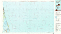
1990 Map of Virginia Beach
USGS Topo · Published 1990About this map
Virginia Beach and the coastal barrier system of southeastern Virginia are documented here in the decade before the turn of the millennium. The landscape is defined by the sharp contrast between the expanding urban reach of North Virginia Beach and the preserved marshlands of the southern coast. Military presence is central to the area's geography, with the U S Naval Amphibious Base and the U S Naval Reservation Fleet Anti-Air Warfare Training Center occupying significant shoreline.
Find a feature on this map
43 named features on this map. Tap any name to fly to it.
Don’t see what you’re looking for? This feature index may not catch every label — zoom into the map to look around manually.
Map Details
Editions of this 1990 Virginia Beach Map
This is the sole edition of this map. No revisions or reprints were ever made.
Other maps of this area

1893 · Virginia Beach
USGS Topo · 1:125,000

1907 · Norfolk
USGS Topo · 1:125,000

1916 · Back Bay
USGS Topo · 1:62,500

1918 · Cape Henry
USGS Topo · 1:62,500

1919 · Cape Henry
USGS Topo · 1:62,500

1939 · Moyock
USGS Topo · 1:62,500

1940 · Barco
USGS Topo · 1:62,500

1943 · Back Bay
USGS Topo · 1:62,500

1943 · Richmond
USGS Topo · 1:250,000

1946 · Moyock
USGS Topo · 1:62,500