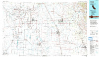
1993 Map of Visalia
USGS Topo · Published 1993About this map
The expansive agricultural basin of the San Joaquin Valley is anchored by the growing municipalities of Visalia, Hanford, and Tulare in the early 1990s. The landscape is defined by an intricate network of irrigation and river systems, including the Kings River, Tule River, and the St Johns River, which feed the surrounding farmlands. A significant historical marker is the Laguna De Tache Grant Bdy, reflecting the era of Spanish and Mexican land grants. In the southwest, the Tule Lake Bed occupies a massive area, showing the altered hydrology of the region.
Find a feature on this map
122 named features on this map. Tap any name to fly to it.
Don’t see what you’re looking for? This feature index may not catch every label — zoom into the map to look around manually.
Map Details
Editions of this 1993 Visalia Map
2 editions found
Other maps of this area

1903 · Tehipite
USGS Topo · 1:125,000

1904 · Kaweah
USGS Topo · 1:125,000

1905 · Tehipite
USGS Topo · 1:125,000

1909 · Kaweah
USGS Topo · 1:125,000

1912 · Coalinga
USGS Topo · 1:125,000

1914 · Lost Hills
USGS Topo · 1:125,000

1914 · Cholame
USGS Topo · 1:125,000

1915 · Cholame
USGS Topo · 1:125,000

1917 · Cholame
USGS Topo · 1:125,000

1921 · Stokes Mountain
USGS Topo · 1:24,000