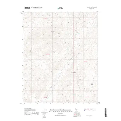
2018 Map of Wabayuma Peak
USGS Topo · Published 2018About this map
Wabayuma Peak anchors this high-elevation desert landscape within the Hualapai Mountains. The terrain is defined by a series of deep drainages including Hibernia Canyon and Boriana Canyon, reflecting a complex network of seasonal water flow across the Mojave Desert. Access into this remote territory is primarily traced via Boriana Mine Rd, which snakes through the southern sections of the quadrangle. Sparse water sources like Grapevine Spring and Bee Springs represent vital landmarks in an otherwise arid environment where intermittent features like Mackenzie Wash and Cone Wash dominate the hydrology. The map illustrates the transition from the high peaks down toward the desert floor, showing how the limited infrastructure of the early 21st century relies on established canyon routes and historical mining access roads.
Find a feature on this map
22 named features on this map. Tap any name to fly to it.
Don’t see what you’re looking for? This feature index may not catch every label — zoom into the map to look around manually.
Map Details
Editions of this 2018 Wabayuma Peak Map
This is the sole edition of this map. No revisions or reprints were ever made.
Other maps of this area

1886 · Diamond Creek
USGS Topo · 1:250,000

1886 · Camp Mohave
USGS Topo · 1:250,000

1892 · Diamond Creek
USGS Topo · 1:250,000

1892 · Camp Mohave
USGS Topo · 1:250,000

1923 · Signal
USGS Topo · 1:250,000

1927 · Yucca
USGS Topo · 1:62,500

1929 · Yucca
USGS Topo · 1:62,500

1942 · Camp Mohave
USGS Topo · 1:250,000

1942 · Signal
USGS Topo · 1:250,000

1947 · Kingman
USGS Topo · 1:250,000