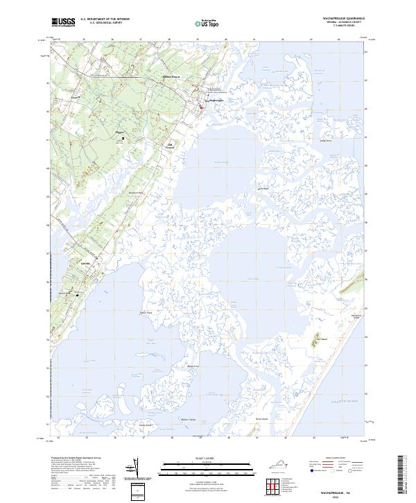
2022 Map of Wachapreague
USGS Topo · Published 2022About this map
Wachapreague and Quinby anchor this coastal landscape on Virginia's Eastern Shore, where the mainland meets a complex network of marshes, channels, and barrier islands. The intricate tidal geography is defined by features like Bradford Bay, Machipongo River, and Swash Bay, revealing a coastline heavily shaped by water movement and maritime access. The map details the transition from agricultural fields and small settlements like Locust Mount and Trower to the expansive salt marshes of the Clubhouse Marsh.
Find a feature on this map
110 named features on this map. Tap any name to fly to it.
Don’t see what you’re looking for? This feature index may not catch every label — zoom into the map to look around manually.
Map Details
Editions of this 2022 Wachapreague Map
This is the sole edition of this map. No revisions or reprints were ever made.
Other maps of this area

1931 · Accomac
USGS Topo · 1:48,000

1935 · Accomac
USGS Topo · 1:62,500

1941 · Broadwater
USGS Topo · 1:62,500

1942 · Little Machipongo Inlet
USGS Topo · 1:24,000

1942 · Nassawadox
USGS Topo · 1:24,000

1943 · Nassawadox
USGS Topo · 1:31,680

1943 · Pungoteague
USGS Topo · 1:31,680

1943 · Exmore
USGS Topo · 1:24,000

1944 · Exmore
USGS Topo · 1:31,680

1946 · Eastville
USGS Topo · 1:250,000