2022 Map of Waldron
USGS Topo · Published 2022About this map
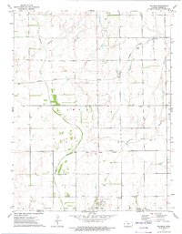
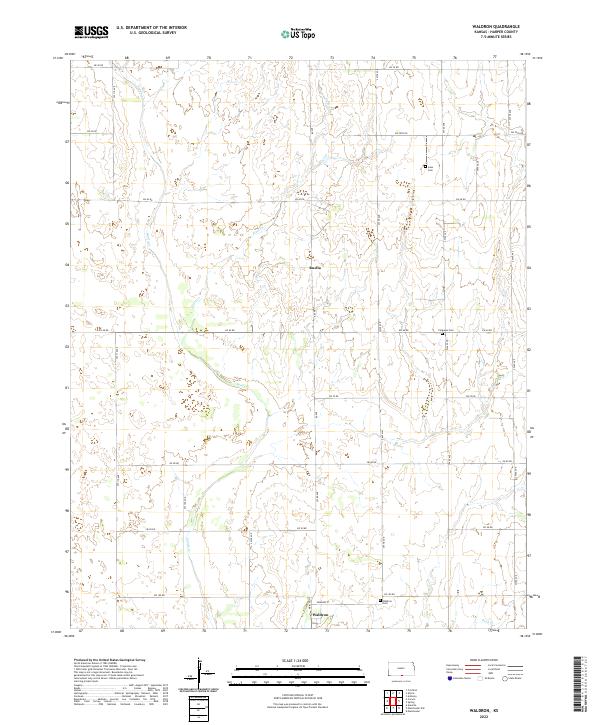
Waldron serves as the primary settlement in this south-central Kansas landscape, located along the southern edge near the Oklahoma border. The area is defined by a grid of agricultural section lines, with Edwards St marking the heart of the small community. Waterways including Sandy Cr and Plum Cr carve subtle drainages through the township blocks, influencing the placement of early homesteads and family burial grounds. Local history is anchored by several small cemeteries, such as Goss Cem and Ferguson Cem, which are scattered throughout the rural sections north of the town. This modern survey reflects a land use pattern largely unchanged since its early development, where the economy remains tied to the drainages of Rush Cr and the surrounding prairie plains.
Find a feature on this map
35 named features on this map. Tap any name to fly to it.
Don’t see what you’re looking for? This feature index may not catch every label — zoom into the map to look around manually.
Map Details
Editions of this 2022 Waldron Map
This is the sole edition of this map. No revisions or reprints were ever made.