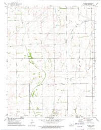
1972 Map of Waldron
USGS Topo · Published 1975About this map
Waldron and the surrounding borderlands of Harper County, Kansas, are captured here in the early 1970s, shortly before the map's mid-decade publication. This prairie landscape is defined by the Old Indian Treaty Boundary, which cuts horizontally across the southern townships above the Oklahoma line. The Missouri Pacific Railroad provides the primary industrial artery, passing through the small community of Ruella and connecting the region's agricultural interests. Local history and genealogy are anchored by several rural burial sites, including Goss Cem and Ferguson Cem, as well as the Waldron Cem located just east of the main settlement. The drainage patterns of Sandy Creek and Plum Creek dictate the local topography, while scattered infrastructure like a Gas Well suggests the early diversification of the rural economy beyond traditional farming.
Find a feature on this map
11 named features on this map. Tap any name to fly to it.
Don’t see what you’re looking for? This feature index may not catch every label — zoom into the map to look around manually.
Map Details
Editions of this 1972 Waldron Map
This is the sole edition of this map. No revisions or reprints were ever made.
Other maps of this area

1889 · Anthony
USGS Topo · 1:125,000

1891 · Anthony
USGS Topo · 1:125,000

1955 · Woodward
USGS Topo · 1:250,000

1955 · Pratt
USGS Topo · 1:250,000

1958 · Woodward
USGS Topo · 1:250,000

1959 · Pratt
USGS Topo · 1:250,000

1969 · Amorita
USGS Topo · 1:24,000
1969 · Manchester
USGS Topo · 1:24,000
1969 · Manchester NW
USGS Topo · 1:24,000

1972 · Attica
USGS Topo · 1:24,000