
1889 Map of Anthony
USGS Topo · Published 1889About this map
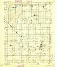
Anthony serves as the focal point of this South Central Kansas landscape, surveyed when the region was a bustling hub of early rail expansion. The Atchison Topeka and Santa Fe Railroad and the Missouri Pacific Railroad define the growth of settlements like Hazelton, Attica, and Harper. To the north, the Chicaskia River winds through Chicaskia and Richland townships, while the southern edge is marked by the Kansas Oklahoma Boundary Line. The presence of small rail stops such as Crisfield, Rago, and New Rochester illustrates the importance of the iron horse in facilitating trade across the prairie. The topography is further defined by the complex drainage systems of Bluff Creek and the Medicine Lodge River, providing a window into the hydrology and settlement patterns of Harper and Kingman counties during the late nineteenth century.
Find a feature on this map
69 named features on this map. Tap any name to fly to it.
Don’t see what you’re looking for? This feature index may not catch every label — zoom into the map to look around manually.
Map Details
Editions of this 1889 Anthony Map
This is the sole edition of this map. No revisions or reprints were ever made.
Other maps of this area

1889 · Cheney
USGS Topo · 1:125,000

1889 · Caldwell
USGS Topo · 1:125,000

1891 · Medicine Lodge
USGS Topo · 1:125,000

1891 · Cheney
USGS Topo · 1:125,000

1891 · Anthony
USGS Topo · 1:125,000

1892 · Kingman
USGS Topo · 1:125,000

1892 · Pratt
USGS Topo · 1:125,000

1893 · Caldwell
USGS Topo · 1:125,000

1893 · Medicine Lodge
USGS Topo · 1:125,000
1894 · Kingman
USGS Topo · 1:125,000