1892 Map of Kingman
USGS Topo · Published 1892About this map
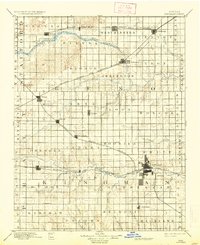
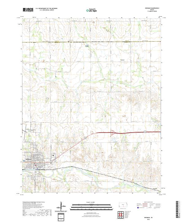
The North Fork Ninnescah River and South Fork Ninnescah River define the drainage of this late nineteenth-century Kansas prairie, converging near the growing county seat at Kingman. This area is heavily influenced by the expansion of competing rail lines, which dictated the placement of grain-shipping centers and small settlements across the plains. The Atchison Topeka and Santa Fe Railroad skirts the northern edge through Sylvia and Partridge, while the Missouri Pacific Railroad cuts a diagonal path through Olcott and Penalosa. A grid of civil townships, including Westminster, Loda, and Ninnescah, organizes the landscape into agricultural blocks. Water sources like Goose Creek and Smoots Creek provided essential resources for early homesteads and cattle, while towns such as Lerado and Cunningham emerged as vital community hubs for the surrounding farmsteads.
Find a feature on this map
61 named features on this map. Tap any name to fly to it.
Don’t see what you’re looking for? This feature index may not catch every label — zoom into the map to look around manually.
Map Details
Editions of this 1892 Kingman Map
This is the sole edition of this map. No revisions or reprints were ever made.
Historical Maps of Kingman Through Time
8 maps found