
1894 Map of Kingman
USGS Topo · Published 1894About this map
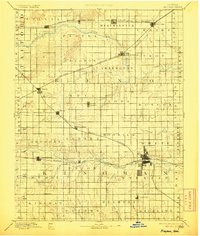
Kingman serves as the focal point of this late-nineteenth-century survey, situated at the confluence of several rail lines and the South Fork Ninnescah River. The landscape is defined by a dense grid of townships, including Dresden, Eureka, and Ninnescah, reflecting the rapid agrarian settlement of the Kansas plains. Four major rail systems, including the Atchison Topeka and Santa Fe Railroad and the Missouri Pacific Railroad, crisscross the territory, dictating the placement of grain-shipping hubs like Cunningham, Arlington, and Turon. Smaller, isolated settlements such as Lerado and Olcott appear as fledgling community centers along these routes. The river drainage systems, including Goose Creek and Smoots Creek, provide the only breaks in the geometric regularity of the surveyed section lines, illustrating how water and steam power combined to organize the early development of this prairie region.
Find a feature on this map
64 named features on this map. Tap any name to fly to it.
Don’t see what you’re looking for? This feature index may not catch every label — zoom into the map to look around manually.
Map Details
Editions of this 1894 Kingman Map
4 editions found
Other maps of this area

1889 · Anthony
USGS Topo · 1:125,000

1889 · Cheney
USGS Topo · 1:125,000

1889 · Caldwell
USGS Topo · 1:125,000

1891 · Great Bend
USGS Topo · 1:125,000

1891 · Medicine Lodge
USGS Topo · 1:125,000

1891 · Hutchinson
USGS Topo · 1:125,000

1891 · Cheney
USGS Topo · 1:125,000

1891 · Anthony
USGS Topo · 1:125,000

1892 · Kingman
USGS Topo · 1:125,000

1892 · Pratt
USGS Topo · 1:125,000