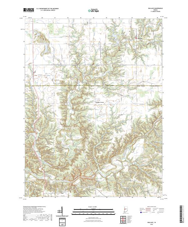
2022 Map of Wallace
USGS Topo · Published 2022About this map
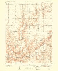
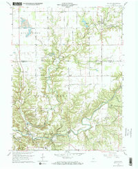
Wallace and Grange Corner anchor this portion of the Indiana countryside along the border of Fountain and Parke Counties. The landscape is defined by the winding descent of Sugar Creek and the intricate drainage of Sugar Mill Creek, which has carved out significant local terrain features like Rocky Hollow and the Narrows. These natural formations created a complex environment for early transport and agricultural settlement, visible today in the dense network of county roads such as Co Rd 1200 N and Co Rd 1100 S.
Find a feature on this map
86 named features on this map. Tap any name to fly to it.
Don’t see what you’re looking for? This feature index may not catch every label — zoom into the map to look around manually.
Map Details
Editions of this 2022 Wallace Map
This is the sole edition of this map. No revisions or reprints were ever made.
Historical Maps of Parke County Through Time
3 maps found