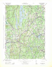
1942 Map of Ware
USGS Topo · Published 1942About this map
The Quabbin Reservoir dominates the center of this landscape, reflecting a massive transformation of the Swift River Valley as it appeared in the early 1940s. While many towns were submerged to create the reservoir, surrounding settlements like Ware Center and Belchertown remained vital hubs. This map reveals a complex industrial and institutional geography, featuring the Bald Peak Hospital and the industrial activity near Three Rivers, where several rail lines converge.
Find a feature on this map
218 named features on this map. Tap any name to fly to it.
Don’t see what you’re looking for? This feature index may not catch every label — zoom into the map to look around manually.
Map Details
Editions of this 1942 Ware Map
This is the sole edition of this map. No revisions or reprints were ever made.
Other maps of this area

1885 · Northampton
USGS Topo · 1:62,500

1885 · Worcester
USGS Topo · 1:62,500

1886 · Springfield
USGS Topo · 1:62,500

1886 · Worcester
USGS Topo · 1:62,500

1886 · Northampton
USGS Topo · 1:62,500

1887 · Brookfield
USGS Topo · 1:62,500

1887 · Warwick
USGS Topo · 1:62,500

1887 · Palmer
USGS Topo · 1:62,500

1887 · Belchertown
USGS Topo · 1:62,500

1887 · Winchendon
USGS Topo · 1:62,500