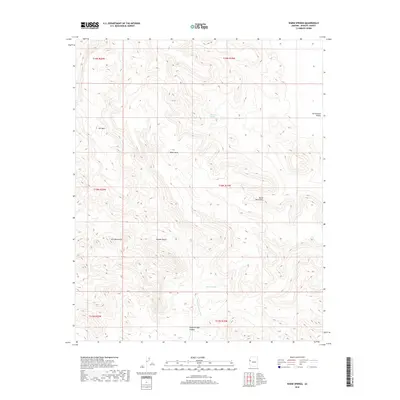
2018 Map of Warm Springs
USGS Topo · Published 2018About this map
Warm Springs sits at the heart of this Mohave County landscape, where the high ridges of the Black Mountains descend toward the Sacramento Valley. This 2018 survey by the U.S. Geological Survey captures a network of vital desert water sources, including Antelope Spring and Alkali Spring, which have historically dictated movement and survival in the Mojave Desert. The topography is dominated by prominent elevations such as Black Mesa and Ute Mtn, part of the broader Ute Mountains chain that defines the western portion of the quadrangle.
Find a feature on this map
17 named features on this map. Tap any name to fly to it.
Don’t see what you’re looking for? This feature index may not catch every label — zoom into the map to look around manually.
Map Details
Editions of this 2018 Warm Springs Map
This is the sole edition of this map. No revisions or reprints were ever made.
Other maps of this area

1886 · Camp Mohave
USGS Topo · 1:250,000

1892 · Camp Mohave
USGS Topo · 1:250,000

1903 · Needles
USGS Topo · 1:125,000

1904 · Needles Special
USGS Topo · 1:125,000

1927 · Yucca
USGS Topo · 1:62,500

1929 · Yucca
USGS Topo · 1:62,500

1942 · Camp Mohave
USGS Topo · 1:250,000

1947 · Kingman
USGS Topo · 1:250,000

1948 · Kingman
USGS Topo · 1:250,000

1954 · Needles
USGS Topo · 1:250,000