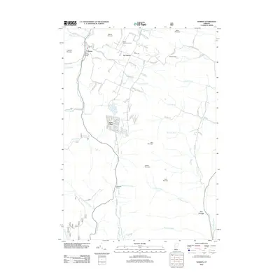
2012 Map of Warren
USGS Topo · Published 2012About this map
The Mad River carves through this valley in central Vermont, anchoring a community defined by its mountain gaps and historic crossings. At the heart of the village, the Warren Covered Bridge stands as a landmark of local craftsmanship, while the nearby Warren Sugarbush Airport on the plateau above indicates the area's modern role as a gateway for mountain recreation. The settlement pattern here follows the narrow lowlands and higher benches, from the cluster at Warren village to the upland hamlet of East Warren and the specialized residential development at Alpine Village.
Find a feature on this map
98 named features on this map. Tap any name to fly to it.
Don’t see what you’re looking for? This feature index may not catch every label — zoom into the map to look around manually.
Map Details
Editions of this 2012 Warren Map
This is the sole edition of this map. No revisions or reprints were ever made.
Other maps of this area

1915 · Rochester
USGS Topo · 1:62,500

1917 · Rochester
USGS Topo · 1:62,500

1919 · Royalton
USGS Topo · 1:62,500

1919 · Lincoln Mountain
USGS Topo · 1:62,500

1920 · Lincoln Mountain
USGS Topo · 1:48,000

1921 · Lincoln Mountain
USGS Topo · 1:62,500

1922 · Barre
USGS Topo · 1:48,000

1924 · Barre
USGS Topo · 1:62,500

1924 · Randolph
USGS Topo · 1:48,000

1926 · Randolph
USGS Topo · 1:62,500