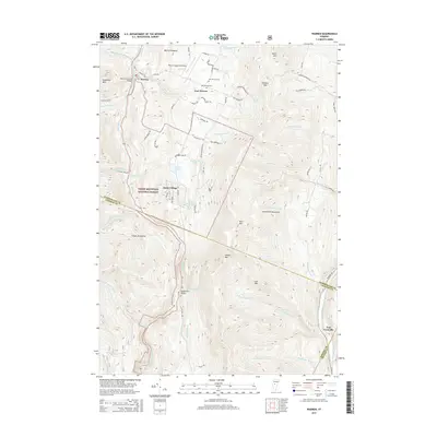
2015 Map of Warren
USGS Topo · Published 2015About this map
Warren Covered Bridge stands as a focal point near the village center, marking a traditional crossing in this 2015 study of the Mad River valley. The settlement pattern reflects a classic Vermont upland landscape, where established clusters like Warren and East Warren are complemented by the modern development of Alpine Village. The terrain is defined by the high ridges of the Green Mountains and the Northfield Mountains, with the Green Mountain National Forest blanketing much of the western slopes. Genealogical interest is centered on Warren Cem and the two distinct East-Warren burial grounds. Significant water features, including Blueberry Lake and the dramatic Moss Glen Falls near Granville Notch, illustrate the area's transition from agricultural use to a modern economy centered on recreation and aviation at the Warren-Sugarbush Airport.
Find a feature on this map
83 named features on this map. Tap any name to fly to it.
Don’t see what you’re looking for? This feature index may not catch every label — zoom into the map to look around manually.
Map Details
Editions of this 2015 Warren Map
This is the sole edition of this map. No revisions or reprints were ever made.
Other maps of this area

1915 · Rochester
USGS Topo · 1:62,500

1917 · Rochester
USGS Topo · 1:62,500

1919 · Royalton
USGS Topo · 1:62,500

1919 · Lincoln Mountain
USGS Topo · 1:62,500

1920 · Lincoln Mountain
USGS Topo · 1:48,000

1921 · Lincoln Mountain
USGS Topo · 1:62,500

1922 · Barre
USGS Topo · 1:48,000

1924 · Barre
USGS Topo · 1:62,500

1924 · Randolph
USGS Topo · 1:48,000

1926 · Randolph
USGS Topo · 1:62,500