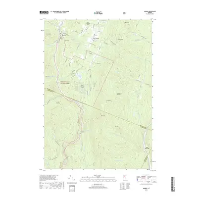
2018 Map of Warren
USGS Topo · Published 2018About this map
Warren sits at the heart of the Mad River Valley, a classic Vermont settlement where the Warren Covered Bridge still spans the water. This 2018 survey illustrates the persistent rural character of the area, defined by the narrow valley floor and the steep ascents of the Northfield Mountains and the Green Mountains. The settlement pattern follows the Mad River, while higher elevations like East Warren and Alpine Village occupy the benches above the valley. Local history is anchored by sites like the Warren Cemetery and East Warren Cemetery, reflecting generations of residence in this corner of Washington County. Beyond the town centers, the landscape is largely protected by the Green Mountain National Forest, with significant topographical features like Granville Notch and Roxbury Gap dictating the routes of travel between the peaks of Adams Mtn and Burnt Mtn.
Find a feature on this map
82 named features on this map. Tap any name to fly to it.
Don’t see what you’re looking for? This feature index may not catch every label — zoom into the map to look around manually.
Map Details
Editions of this 2018 Warren Map
This is the sole edition of this map. No revisions or reprints were ever made.
Other maps of this area

1915 · Rochester
USGS Topo · 1:62,500

1917 · Rochester
USGS Topo · 1:62,500

1919 · Royalton
USGS Topo · 1:62,500

1919 · Lincoln Mountain
USGS Topo · 1:62,500

1920 · Lincoln Mountain
USGS Topo · 1:48,000

1921 · Lincoln Mountain
USGS Topo · 1:62,500

1922 · Barre
USGS Topo · 1:48,000

1924 · Barre
USGS Topo · 1:62,500

1924 · Randolph
USGS Topo · 1:48,000

1926 · Randolph
USGS Topo · 1:62,500