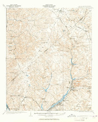
1943 Map of Warrenville
USGS Topo · Published 1943About this map
Horse Creek dictates the industrial and residential heart of this region, anchoring a corridor of mill towns and settlements that define the landscape in the early 1940s. The dense concentration of communities including Warrenville, Graniteville, and Vaucluse illustrates the textile-driven economy of the era, while the Southern railroad provides the primary connection between these manufacturing hubs. Beyond the industrial centers, the map reveals a rural expanse defined by community-centric landmarks like Bettis Academy and Horn Creek Ch.
Find a feature on this map
62 named features on this map. Tap any name to fly to it.
Don’t see what you’re looking for? This feature index may not catch every label — zoom into the map to look around manually.
Map Details
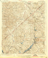
Editions of this 1943 Warrenville Map
This is the sole edition of this map. No revisions or reprints were ever made.
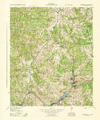
Historical Maps of Augusta Through Time
3 maps found