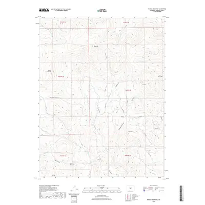
2019 Map of Waugh Mountain
USGS Topo · Published 2019About this map
Waugh Mtn and Loco Mtn dominate the high-elevation landscape of Fremont County, where a complex network of gulches and drainage basins defines the terrain. The map details a transition from the prominent peaks of Stoney Face Mtn and Burris Mtn to the deeply carved incisions of Waugh Gulch, Long Gulch, and Green Mountain Gulch. These natural corridors have long influenced local transit, evidenced by the modern placement of Waugh Mtn Rd and Co Rd 12.
Find a feature on this map
46 named features on this map. Tap any name to fly to it.
Don’t see what you’re looking for? This feature index may not catch every label — zoom into the map to look around manually.
Map Details
Editions of this 2019 Waugh Mountain Map
This is the sole edition of this map. No revisions or reprints were ever made.
Other maps of this area

1954 · Pueblo
USGS Topo · 1:250,000

1956 · Cameron Mountain
USGS Topo · 1:62,500

1957 · Pueblo
USGS Topo · 1:250,000

1958 · Pueblo
USGS Topo · 1:250,000

1959 · Black Mountain
USGS Topo · 1:62,500

1959 · Howard
USGS Topo · 1:62,500

1959 · Cotopaxi
USGS Topo · 1:62,500

1962 · Pueblo
USGS Topo · 1:250,000

1966 · Pueblo
USGS Topo · 1:250,000
1980 · Echo
USGS Topo · 1:24,000