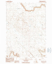
1990 Map of Weaver Lake
USGS Topo · Published 1990About this map
Sage Hen Valley dominates the northern landscape of this high-desert region in Harney County, where the terrain is defined by a network of seasonal water catchments. The map reveals a specific cattle-country economy through features like Lost Lake Waterhole and Lookout Butte Reservoir, critical infrastructure in a land where many water bodies are ephemeral. The survey identifies numerous arid basins including Frank Schmidt Lake, Albert Lake, and the namesake Weaver Lake, suggesting a cycle of seasonal inundation and dry lake beds. Family-named landmarks such as West Batts Camp Lake and Scotts Canyon provide genealogical anchors for the area's ranching history. This 1990 edition, based on 1980s aerial photography, documents the land just as modern conservation and land management practices were being codified in the Oregon desert.
Find a feature on this map
17 named features on this map. Tap any name to fly to it.
Don’t see what you’re looking for? This feature index may not catch every label — zoom into the map to look around manually.
Map Details
Editions of this 1990 Weaver Lake Map
This is the sole edition of this map. No revisions or reprints were ever made.
Other maps of this area

1955 · Burns
USGS Topo · 1:250,000

1958 · Burns
USGS Topo · 1:250,000

1959 · Burns
USGS Topo · 1:250,000

1959 · Dog Mountain
USGS Topo · 1:62,500

1960 · Burns
USGS Topo · 1:62,500

1960 · Burns
USGS Topo · 1:24,000

1975 · Burns
USGS Topo · 1:24,000

1980 · Stinking Lake
USGS Topo · 1:24,000

1980 · Palomino Buttes
USGS Topo · 1:24,000

1981 · Sage Hen Hill
USGS Topo · 1:24,000