Loading...
Loading map...2022 Map of Weddington
USGS Topo · Published 2022About this map
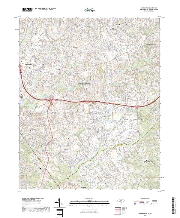
Weddington and the surrounding suburbs of Charlotte sit along the rolling border where North Carolina meets South Carolina. This modern topographic study reveals a landscape heavily shaped by suburban expansion and water management, centered on the I-485 corridor and Pineville Matthews Rd. The area is defined by its numerous small reservoirs and community focal points, including Quail Hollow Country Club Lake and Lake Providence.
Find a feature on this map
38 named features on this map. Tap any name to fly to it.
Don’t see what you’re looking for? This feature index may not catch every label — zoom into the map to look around manually.
Map Details
Date Portrayed2022
Date Published2022
PublisherU.S. Geological Survey
Map TypeTopographic
Scale1:24000
Physical Dimensions24 x 29 inches
Editions of this 2022 Weddington Map
This is the sole edition of this map. No revisions or reprints were ever made.
Historical Maps of Charlotte Through Time
Featured Locations
Source Details
SourceU.S. Geological Survey
CopyrightPublic Domain