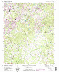
1968 Map of Weddington
USGS Topo · Published 1989About this map
The boundary lines of the North Carolina South Carolina border and the meeting of Mecklenburg Co Union Co define this landscape south of Charlotte. By the late 1960s, suburban expansion from the city was already reshaping the area, evidenced by the development around Olde Providence and the established fairways of the Quail Hollow Country Club. Despite this growth, older community anchors remain visible, including Providence Ch and the Silver Run Cem near Pleasant Valley.
Find a feature on this map
45 named features on this map. Tap any name to fly to it.
Don’t see what you’re looking for? This feature index may not catch every label — zoom into the map to look around manually.
Map Details
Editions of this 1968 Weddington Map
4 editions found
Other maps of this area

1905 · Charlotte
USGS Topo · 1:48,000

1907 · Charlotte
USGS Topo · 1:62,500

1941 · Charlotte
USGS Topo · 1:125,000

1941 · Spartanburg
USGS Topo · 1:250,000

1942 · Charlotte
USGS Topo · 1:125,000

1948 · Charlotte East
USGS Topo · 1:24,000

1948 · Charlotte West
USGS Topo · 1:24,000

1949 · Charlotte West
USGS Topo · 1:24,000

1949 · Charlotte East
USGS Topo · 1:24,000

1949 · Wilgrove
USGS Topo · 1:24,000