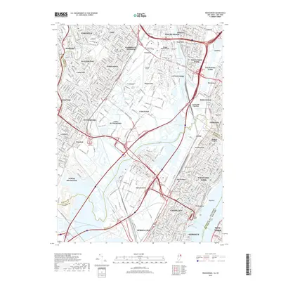
2019 Map of Weehawken
USGS Topo · Published 2019About this map
Kings Bluff and the heights of Weehawken overlook the industrial and transit arteries connecting New Jersey to Manhattan in the late 2010s. This survey details the complex geography of the Hackensack River valley, where extensive wetlands like Eight Day Swamp and Walden Swamp coexist with a dense network of logistics hubs and transit infrastructure. Notable landmarks include the Lincoln Tunnel and the New York Susquehanna and Western Tunnel, illustrating the area's role as a critical corridor.
Find a feature on this map
128 named features on this map. Tap any name to fly to it.
Don’t see what you’re looking for? This feature index may not catch every label — zoom into the map to look around manually.
Map Details
Editions of this 2019 Weehawken Map
This is the sole edition of this map. No revisions or reprints were ever made.
Other maps of this area

1888 · Paterson
USGS Topo · 1:62,500

1889 · Brooklyn
USGS Topo · 1:62,500

1891 · Brooklyn
USGS Topo · 1:62,500

1891 · Harlem
USGS Topo · 1:62,500

1892 · Paterson
USGS Topo · 1:62,500

1897 · Harlem
USGS Topo · 1:62,500

1897 · Brooklyn
USGS Topo · 1:62,500

1898 · Harlem
USGS Topo · 1:62,500

1898 · Staten Island
USGS Topo · 1:62,500

1898 · Brooklyn
USGS Topo · 1:62,500