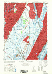
1947 Map of Weehawken
USGS Topo · Published 1947About this map
The Hackensack River and Berry Creek wind through a complex industrial and transport landscape just west of the Hudson River in the late 1940s. This survey highlights the dense rail infrastructure of the era, centered on the massive Secaucus Yards and Secaucus Sta, which served as a critical hub for the Erie RR and Lackawanna and Western RR. The map captures a moment when the tidal marshes of Walden Swamp and Eight Day Swamp still separated the growing boroughs of Moonachie, Carlstadt, and Little Ferry from the more developed heights.
Find a feature on this map
89 named features on this map. Tap any name to fly to it.
Don’t see what you’re looking for? This feature index may not catch every label — zoom into the map to look around manually.
Map Details
Editions of this 1947 Weehawken Map
This is the sole edition of this map. No revisions or reprints were ever made.
Other maps of this area

1888 · Paterson
USGS Topo · 1:62,500

1889 · Brooklyn
USGS Topo · 1:62,500

1891 · Brooklyn
USGS Topo · 1:62,500

1891 · Harlem
USGS Topo · 1:62,500

1892 · Paterson
USGS Topo · 1:62,500

1897 · Harlem
USGS Topo · 1:62,500

1897 · Brooklyn
USGS Topo · 1:62,500

1898 · Harlem
USGS Topo · 1:62,500

1898 · Staten Island
USGS Topo · 1:62,500

1898 · Brooklyn
USGS Topo · 1:62,500