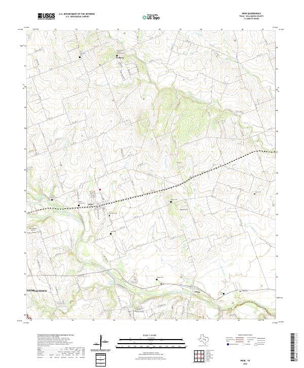
2022 Map of Weir
USGS Topo · Published 2022About this map
The San Gabriel River serves as the primary drainage for this portion of Williamson County, where the agricultural landscape is dotted with several small communities and historic burial sites. The settlements of Walburg, Weir, and Jonah anchor the region, connected by a network of farm roads and county lanes. Genealogists will find a high concentration of cemeteries reflecting early settlement patterns, including the Zion Lutheran Cem and Saint Peters Lutheran Church Cem in the north, and several family-named grounds such as the Magee Cem, Yoes Cem, and Salyer Cem. This landscape transition is evident near Queen Hill, where the elevation shifts toward the river bottom. To the west, the map includes the outskirts of Georgetown and aviation markers like the Bar 3 Ranch Airport, while several creeks like Yankee Br and Mileham Br feed into the river valley, marking the natural topography of the Texas blackland prairies.
Find a feature on this map
114 named features on this map. Tap any name to fly to it.
Don’t see what you’re looking for? This feature index may not catch every label — zoom into the map to look around manually.
Map Details
Editions of this 2022 Weir Map
This is the sole edition of this map. No revisions or reprints were ever made.