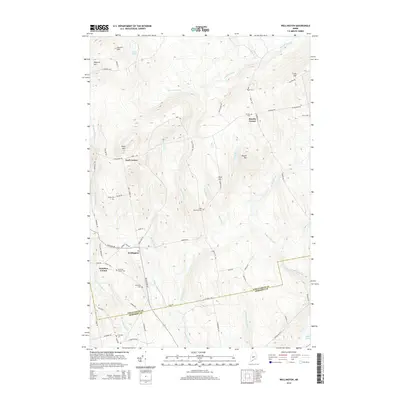
2014 Map of Wellington
USGS Topo · Published 2014About this map
The settlement of Wellington serves as a central hub in this landscape along the Somerset and Piscataquis county line. The map reveals a high density of small family and community burial grounds, such as Hutchins Corner Cem, Burdins Cem, and the uniquely named Klondike Cem, which offer significant value for genealogical research in this rural Maine region. The terrain is defined by a series of named elevations including Huff Mtn and Cowett Hill, with the drainage network primarily fed by Carlton Stream and Higgins Stream. Several small crossroads communities, such as Burdin Corner, Huff Corner, and Hutchins Corner, anchor the local road system. The presence of logging roads, like Logging Rd near Huff Corner, and numerous brooks like Buzzell Brook and Ferguson Brook, illustrates a landscape deeply tied to its natural watercourses and timber resources.
Find a feature on this map
68 named features on this map. Tap any name to fly to it.
Don’t see what you’re looking for? This feature index may not catch every label — zoom into the map to look around manually.
Map Details
Editions of this 2014 Wellington Map
This is the sole edition of this map. No revisions or reprints were ever made.
Other maps of this area

1913 · Skowhegan
USGS Topo · 1:62,500

1930 · Pittsfield
USGS Topo · 1:48,000

1932 · Pittsfield
USGS Topo · 1:62,500

1933 · Pittsfield
USGS Topo · 1:62,500

1933 · Guilford
USGS Topo · 1:62,500

1937 · Guilford
USGS Topo · 1:62,500

1948 · Bangor
USGS Topo · 1:250,000

1948 · Kingsbury
USGS Topo · 1:62,500

1950 · Kingsbury
USGS Topo · 1:62,500

1954 · Millinocket
USGS Topo · 1:250,000