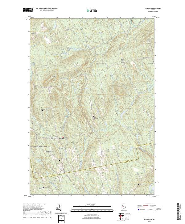
2024 Map of Wellington
USGS Topo · Published 2024About this map
Wellington sits at the heart of this landscape, where the border of Piscataquis Co and Somerset Co defines the southern reach of the survey. The terrain is characterized by a high density of wetlands and bogs, including Long Bog, Lily Bog, and Wellington Bog, which drain into a network of streams like Higgins Stream and Carlton Stream. This area is a critical resource for genealogists, as it preserves the locations of numerous family-named burial grounds. From Burdins Corner Cem in the northeast to Klondike Cem in the southwest, these sites are often associated with early settlement clusters like Hutchins Corner. The prominence of features such as Huff Mtn and King Hill illustrates the varied elevations that dictated early road placements, including Parkman Rd and Wellington Rd.
Find a feature on this map
79 named features on this map. Tap any name to fly to it.
Don’t see what you’re looking for? This feature index may not catch every label — zoom into the map to look around manually.
Map Details
Editions of this 2024 Wellington Map
This is the sole edition of this map. No revisions or reprints were ever made.
Other maps of this area

1913 · Skowhegan
USGS Topo · 1:62,500

1930 · Pittsfield
USGS Topo · 1:48,000

1932 · Pittsfield
USGS Topo · 1:62,500

1933 · Pittsfield
USGS Topo · 1:62,500

1933 · Guilford
USGS Topo · 1:62,500

1937 · Guilford
USGS Topo · 1:62,500

1948 · Bangor
USGS Topo · 1:250,000

1948 · Kingsbury
USGS Topo · 1:62,500

1950 · Kingsbury
USGS Topo · 1:62,500

1954 · Millinocket
USGS Topo · 1:250,000