2022 Map of West Chester
USGS Topo · Published 2022About this map
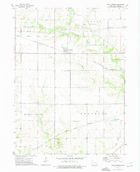
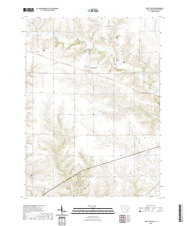
West Chester sits at the heart of this agricultural landscape in Washington County, where the regular grid of township roads is broken by the winding courses of W Fork Crooked Cr and Cedar Cr. The settlement patterns here reflect a strong community history, preserved in a high density of rural burial grounds such as Westminster Cem, Roberts Chapel Cem, and New Haven Cem. The Kewash Nature Trl cuts diagonally across the northern half of the map, following a legacy corridor through the fields. In the southern portion, the small community of Grace Hill is positioned near the headwaters of Indian Cr, flanked by Grace Hill Cem and Todd Cem. The map provides a clear look at the intricate drainage systems that define the Iowa prairie, including the secluded Hoot Owl Hollow in the west.
Find a feature on this map
48 named features on this map. Tap any name to fly to it.
Don’t see what you’re looking for? This feature index may not catch every label — zoom into the map to look around manually.
Map Details
Editions of this 2022 West Chester Map
This is the sole edition of this map. No revisions or reprints were ever made.