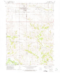
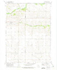
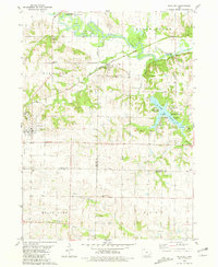
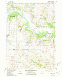
1973 Map of West Chester
USGS Topo · Published 1975About this map
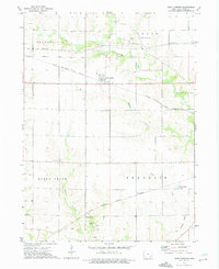
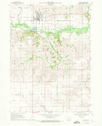
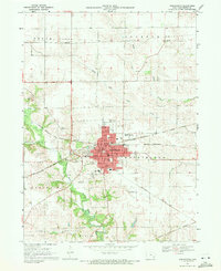
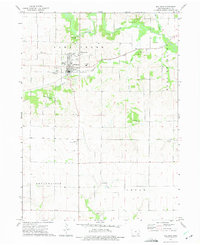
West Chester serves as the central hub for this rural portion of Washington County, situated along the Chicago Rock Island and Pacific railroad line. The landscape is defined by its agricultural character and a network of creeks, including the West Fork Crooked Creek and Indian Creek, which carve through the townships of Seventy-Six, Cedar, and Dutch Creek. To the south, the settlement of Grace Hill sits near the Chicago Milwaukee St Paul and Pacific tracks and an Old Railroad Grade, illustrating the area's historical reliance on rail transportation.
Find a feature on this map
22 named features on this map. Tap any name to fly to it.
Don’t see what you’re looking for? This feature index may not catch every label — zoom into the map to look around manually.
Map Details
Editions of this 1973 West Chester Map
This is the sole edition of this map. No revisions or reprints were ever made.
Other maps of this area

1958 · Davenport
USGS Topo · 1:250,000

1961 · Davenport
USGS Topo · 1:250,000

1962 · Davenport
USGS Topo · 1:250,000
1969 · Kalona
USGS Topo · 1:24,000
1969 · Washington
USGS Topo · 1:24,000
1973 · Wellman
USGS Topo · 1:24,000
1973 · Keota
USGS Topo · 1:24,000
1973 · Kinross
USGS Topo · 1:24,000
1980 · Richland
USGS Topo · 1:24,000
1980 · Brighton
USGS Topo · 1:24,000