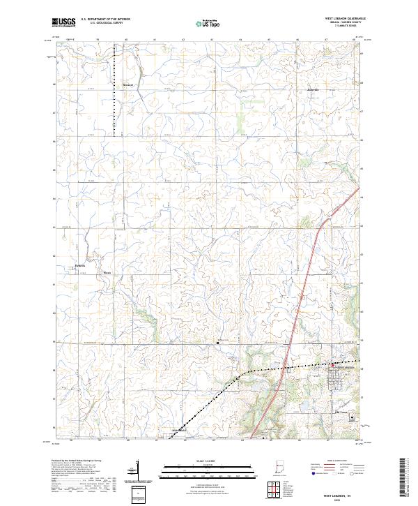
2022 Map of West Lebanon
USGS Topo · Published 2022About this map
West Lebanon and its neighboring agricultural communities anchor this portion of Warren County, where the landscape is defined by a grid of rural roads and numerous small watercourses. The town of West Lebanon shows its traditional core along W NW St and W 3rd St, adjacent to the area identified as Old Town and the West Lebanon Cem. To the west, smaller settlements like Marshfield, Sloan, and Hedrick are linked by a network of county roads such as W State Rd 28. The terrain is carved by intricate drainage systems including Redwood Creek, Opossum Run, and Mud Run. These waterways, along with family-named landmarks like the Shanklin Hill Cem and Redwood Cem, offer a detailed view of the township’s historical layout and its enduring rural character in the early 21st century.
Find a feature on this map
42 named features on this map. Tap any name to fly to it.
Don’t see what you’re looking for? This feature index may not catch every label — zoom into the map to look around manually.
Map Details
Editions of this 2022 West Lebanon Map
This is the sole edition of this map. No revisions or reprints were ever made.