2021 Map of West Line
USGS Topo · Published 2021About this map
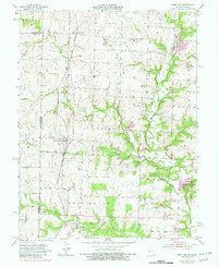
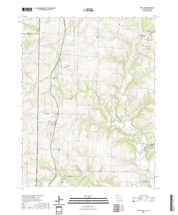
West Line and Cleveland sit along the western edge of Cass County, marking a landscape where Missouri meets the Kansas state line. This 2021 survey illustrates a region defined by scattered residential clusters and small rural airfields like Williams Airport and Veach Field. The terrain is drained by the winding S Grand River and Poney Cr, with several significant water bodies including Al Jurgeson Lake and Lake Annette punctuating the low-lying areas. For genealogists and local historians, the map provides precise locations for established burial grounds such as Frazee Cem, Corinth Cem, and Glenwild Cem, which serve as vital anchors for the area's community history. While the township of Peculiar and the village of Freeman appear on the eastern margins, the interior remains largely rural, crisscrossed by a grid of numbered roads that maintain the traditional section lines of the Midwest.
Find a feature on this map
62 named features on this map. Tap any name to fly to it.
Don’t see what you’re looking for? This feature index may not catch every label — zoom into the map to look around manually.
Map Details
Editions of this 2021 West Line Map
This is the sole edition of this map. No revisions or reprints were ever made.