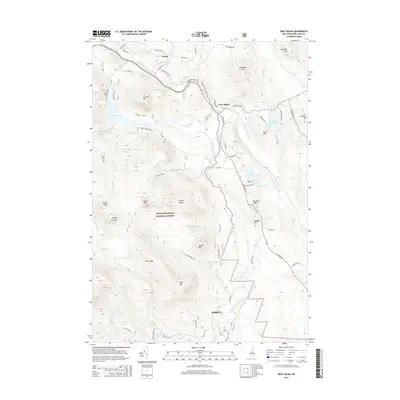
2015 Map of West Milan
USGS Topo · Published 2015About this map
The Upper Ammonoosuc River carves a deep valley through the northern Coos County landscape, orienting the primary settlements of West Milan and Crystal. This area serves as a significant gateway to the northern reaches of the White Mountain National Forest, where the terrain rises sharply into prominent landforms such as North Peak and Greens Ledge. Local transport patterns are defined by the river’s path, with W Milan Rd and the Upper Ammonoosuc River running parallel through the gap between Cummings Mtn and Horn Hill. To the south, the city of Berlin marks the edge of this more mountainous terrain, where the W Br Upper Ammonoosuc River and York Pond are situated. The map provides a detailed view of the drainage systems and peaks that shaped the region's logging and recreational history, including the South Ponds and the isolated Kilback Pond.
Find a feature on this map
67 named features on this map. Tap any name to fly to it.
Don’t see what you’re looking for? This feature index may not catch every label — zoom into the map to look around manually.
Map Details
Editions of this 2015 West Milan Map
This is the sole edition of this map. No revisions or reprints were ever made.
Other maps of this area

1893 · Mt. Washington
USGS Topo · 1:62,500

1893 · Gorham
USGS Topo · 1:62,500

1896 · Mt. Washington
USGS Topo · 1:62,500

1896 · Gorham
USGS Topo · 1:62,500

1930 · Milan
USGS Topo · 1:62,500

1930 · Percy
USGS Topo · 1:62,500

1933 · Milan
USGS Topo · 1:62,500

1934 · Percy
USGS Topo · 1:62,500

1934 · Milan
USGS Topo · 1:62,500

1935 · Mt. Washington
USGS Topo · 1:62,500