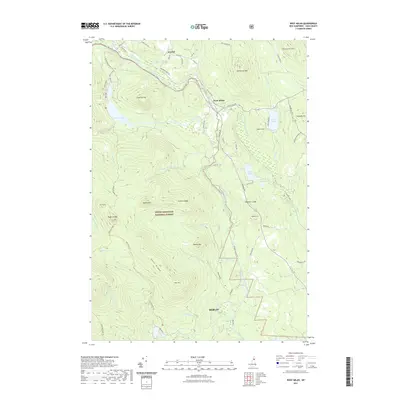
2021 Map of West Milan
USGS Topo · Published 2021About this map
The Upper Ammonoosuc River carves a deep valley through the northern reaches of the White Mountain National Forest in this contemporary record of Coos County. The small village of West Milan serves as a central hub near the river's bend, while the community of Crystal marks the northwestern corner along Phillips Brook. This landscape is defined by its dramatic relief, where ridges like Deer Ridge and peaks such as Rogers Ledge tower over a network of isolated water bodies, including Kilback Pond and South Ponds. The presence of the Berlin city boundary to the south indicates the proximity of more industrial centers, though the map area itself remains largely defined by forest management and conservation. Notable features like York Pond and the extensive network of forest roads, such as Woodbury Cole Rd and W Milan Shomo Trl, reveal a terrain utilized for recreation and resource access in the modern era.
Find a feature on this map
70 named features on this map. Tap any name to fly to it.
Don’t see what you’re looking for? This feature index may not catch every label — zoom into the map to look around manually.
Map Details
Editions of this 2021 West Milan Map
This is the sole edition of this map. No revisions or reprints were ever made.
Other maps of this area

1893 · Mt. Washington
USGS Topo · 1:62,500

1893 · Gorham
USGS Topo · 1:62,500

1896 · Mt. Washington
USGS Topo · 1:62,500

1896 · Gorham
USGS Topo · 1:62,500

1930 · Milan
USGS Topo · 1:62,500

1930 · Percy
USGS Topo · 1:62,500

1933 · Milan
USGS Topo · 1:62,500

1934 · Percy
USGS Topo · 1:62,500

1934 · Milan
USGS Topo · 1:62,500

1935 · Mt. Washington
USGS Topo · 1:62,500