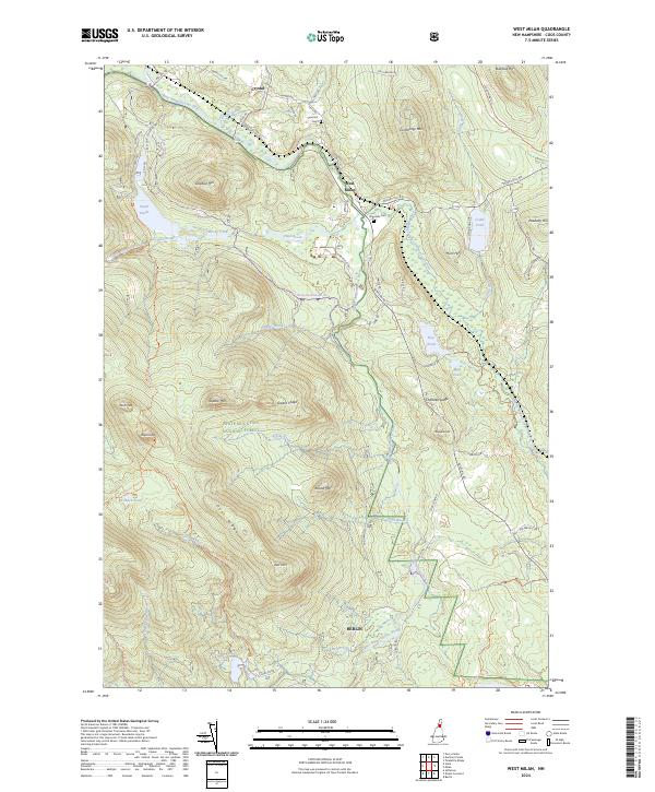
2024 Map of West Milan
USGS Topo · Published 2024About this map
The Upper Ammonoosuc River carves a path through the heart of the northern New Hampshire woods, defining the settlement patterns and transport corridors for West Milan and Crystal. This 2024 map documents a landscape where traditional burial sites like Riverside Cem and Sand Hill Cem sit near the river's bend, while the southern half of the quadrangle is dominated by the sprawling protected acreage of the White Mountain National Forest. High peaks and ridges including Deer Mtn, Greens Ledge, and Square Mtn rise sharply from the valley floors, separated by drainages like Phillips Brook and Cedar Brook. Remote infrastructure is visible at Bog Dam on the edge of Berlin, illustrating the water management history in this timber-rich region. The map provides clear detail of modern recreational access via the Kilkenny Ridge Trl and the Rocky Pond Snomo Trl.
Find a feature on this map
71 named features on this map. Tap any name to fly to it.
Don’t see what you’re looking for? This feature index may not catch every label — zoom into the map to look around manually.
Map Details
Editions of this 2024 West Milan Map
This is the sole edition of this map. No revisions or reprints were ever made.
Other maps of this area

1893 · Mt. Washington
USGS Topo · 1:62,500

1893 · Gorham
USGS Topo · 1:62,500

1896 · Mt. Washington
USGS Topo · 1:62,500

1896 · Gorham
USGS Topo · 1:62,500

1930 · Milan
USGS Topo · 1:62,500

1930 · Percy
USGS Topo · 1:62,500

1933 · Milan
USGS Topo · 1:62,500

1934 · Percy
USGS Topo · 1:62,500

1934 · Milan
USGS Topo · 1:62,500

1935 · Mt. Washington
USGS Topo · 1:62,500