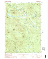
1988 Map of West Milan
USGS Topo · Published 1988About this map
The Upper Ammonoosuc River carves a deep valley through the northern Coos County landscape, serving as the primary corridor for settlement and transit between the rugged heights of the White Mountain National Forest and the Kilkenny region. Along its banks, the small communities of Crystal and West Milan are situated amidst a complex network of waterways, including Phillips Brook and Pond Brook. The terrain is defined by prominent elevations such as Rogers Ledge, Greens Ledge, and Cummings Mtn, which frame the narrow agricultural and residential zones. In the south, the Berlin Fish Hatchery and Jericho Lake Park indicate the transition toward more industrialized areas, while numerous Sand Pits and a Gravel Pit suggest the local importance of resource extraction during the late twentieth century.
Find a feature on this map
44 named features on this map. Tap any name to fly to it.
Don’t see what you’re looking for? This feature index may not catch every label — zoom into the map to look around manually.
Map Details
Editions of this 1988 West Milan Map
This is the sole edition of this map. No revisions or reprints were ever made.
Other maps of this area

1893 · Mt. Washington
USGS Topo · 1:62,500

1893 · Gorham
USGS Topo · 1:62,500

1896 · Mt. Washington
USGS Topo · 1:62,500

1896 · Gorham
USGS Topo · 1:62,500

1930 · Milan
USGS Topo · 1:62,500

1930 · Percy
USGS Topo · 1:62,500

1933 · Milan
USGS Topo · 1:62,500

1934 · Percy
USGS Topo · 1:62,500

1934 · Milan
USGS Topo · 1:62,500

1935 · Mt. Washington
USGS Topo · 1:62,500