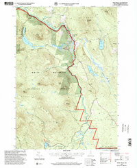
1995 Map of West Milan
USGS Topo · Published 2000About this map
West Milan and the small settlement of Crystal occupy the northern valley of the Upper Ammonoosuc River, where the river winds between the town boundaries of Stark, Dummer, and Milan. This landscape is heavily defined by the expansive White Mountain National Forest and Nash Stream Forest, creating a transition from river-level agriculture to high-elevation forest management. The southern portion of the map highlights specialized state land use, including the Berlin Fish Hatchery near York Pond and the public recreation facilities at Jericho Lake.
Find a feature on this map
45 named features on this map. Tap any name to fly to it.
Don’t see what you’re looking for? This feature index may not catch every label — zoom into the map to look around manually.
Map Details
Editions of this 1995 West Milan Map
This is the sole edition of this map. No revisions or reprints were ever made.
Other maps of this area

1893 · Mt. Washington
USGS Topo · 1:62,500

1893 · Gorham
USGS Topo · 1:62,500

1896 · Mt. Washington
USGS Topo · 1:62,500

1896 · Gorham
USGS Topo · 1:62,500

1930 · Milan
USGS Topo · 1:62,500

1930 · Percy
USGS Topo · 1:62,500

1933 · Milan
USGS Topo · 1:62,500

1934 · Percy
USGS Topo · 1:62,500

1934 · Milan
USGS Topo · 1:62,500

1935 · Mt. Washington
USGS Topo · 1:62,500