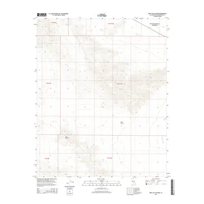
2015 Map of West of Glasgow
USGS Topo · Published 2015About this map
The Bristol Mountains dominate the western portion of this desert landscape, characterized by dramatic elevation changes within the Mojave Desert. This 2015 survey reveals a terrain defined by arid watercourses and protected lands, most notably the southern reaches of the Mojave National Preserve in the northeast corner. Drainage patterns are clearly visible through Kelso Wash and Budweiser Wash, which carve through the alluvial fans at the base of the mountain ranges. The map provides a detailed topographic study of an uninhabited region of San Bernardino County, where the lack of developed roads or settlements highlights the isolation of this corner of the California desert. The intricate contour lines illustrate the complex geological formations that define the transition from high peaks to the desert floor.
Find a feature on this map
11 named features on this map. Tap any name to fly to it.
Don’t see what you’re looking for? This feature index may not catch every label — zoom into the map to look around manually.
Map Details
Editions of this 2015 West of Glasgow Map
This is the sole edition of this map. No revisions or reprints were ever made.
Other maps of this area

1910 · Ivanpah
USGS Topo · 1:250,000

1912 · Ivanpah
USGS Topo · 1:250,000

1933 · Avawatz Mountains
USGS Topo · 1:250,000

1942 · Ivanpah
USGS Topo · 1:250,000

1942 · Amboy
USGS Topo · 1:250,000

1943 · Amboy
USGS Topo · 1:250,000

1947 · Trona
USGS Topo · 1:250,000

1947 · Kingman
USGS Topo · 1:250,000

1948 · Kingman
USGS Topo · 1:250,000

1948 · Trona
USGS Topo · 1:250,000