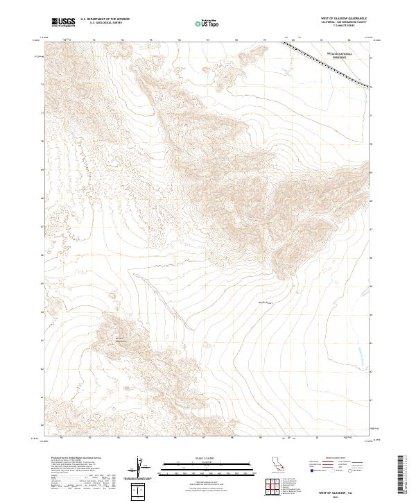
2021 Map of West of Glasgow
USGS Topo · Published 2021About this map
The Mojave National Preserve occupies the northeastern corner of this arid landscape, a protected expanse of the high desert environment in San Bernardino County. The northern reaches are defined by the wide drainage of Kelso Wash, which trends eastward across the flats towards the preserve. In the southern half of the map, the Bristol Mountains rise sharply, their complex topography and steep contours creating a stark contrast to the surrounding desert floor. This region is characterized by significant ephemeral drainage systems, including Budweiser Wash in the southeast, which channels seasonal runoff from the mountains into the wider Mojave Desert. The map reveals a landscape defined by natural topography rather than human settlement, preserving the undisturbed character of these desert ranges and washes.
Find a feature on this map
11 named features on this map. Tap any name to fly to it.
Don’t see what you’re looking for? This feature index may not catch every label — zoom into the map to look around manually.
Map Details
Editions of this 2021 West of Glasgow Map
This is the sole edition of this map. No revisions or reprints were ever made.
Other maps of this area

1910 · Ivanpah
USGS Topo · 1:250,000

1912 · Ivanpah
USGS Topo · 1:250,000

1933 · Avawatz Mountains
USGS Topo · 1:250,000

1942 · Ivanpah
USGS Topo · 1:250,000

1942 · Amboy
USGS Topo · 1:250,000

1943 · Amboy
USGS Topo · 1:250,000

1947 · Trona
USGS Topo · 1:250,000

1947 · Kingman
USGS Topo · 1:250,000

1948 · Kingman
USGS Topo · 1:250,000

1948 · Trona
USGS Topo · 1:250,000