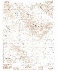
1985 Map of West of Glasgow
USGS Topo · Published 1985About this map
The Bristol Mountains dominate this arid landscape, their steep contours and complex ridge lines defining the topography of this portion of the Mojave. This 1985 provisional survey captures a vast section of the East Mojave National Scenic Area, showing a terrain largely undisturbed by modern development or permanent settlements. The map illustrates the natural drainage patterns of the desert, where ephemeral watercourses like Kelso Wash and Budweiser Wash cut through the sandy plains between the mountain ranges. To the south, the distinct landform of Broadwell Mesa stands apart from the surrounding peaks. The absence of roads and human structures highlights the wilderness character of the region during the mid-1980s, serving as a baseline for understanding the geography of San Bernardino County's high desert before later environmental designations.
Find a feature on this map
6 named features on this map. Tap any name to fly to it.
Don’t see what you’re looking for? This feature index may not catch every label — zoom into the map to look around manually.
Map Details
Editions of this 1985 West of Glasgow Map
This is the sole edition of this map. No revisions or reprints were ever made.
Other maps of this area

1910 · Ivanpah
USGS Topo · 1:250,000

1912 · Ivanpah
USGS Topo · 1:250,000

1933 · Avawatz Mountains
USGS Topo · 1:250,000

1942 · Ivanpah
USGS Topo · 1:250,000

1942 · Amboy
USGS Topo · 1:250,000

1943 · Amboy
USGS Topo · 1:250,000

1947 · Trona
USGS Topo · 1:250,000

1947 · Kingman
USGS Topo · 1:250,000

1948 · Kingman
USGS Topo · 1:250,000

1948 · Trona
USGS Topo · 1:250,000