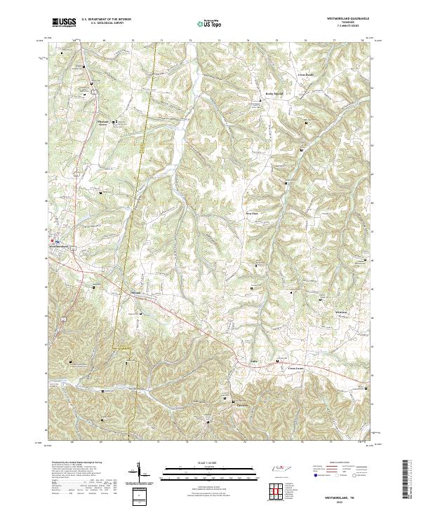
2022 Map of Westmoreland
USGS Topo · Published 2022About this map
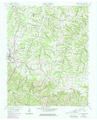
Westmoreland serves as a central hub in this landscape where the Sumner Co Macon Co line divides a terrain defined by deep hollows and creek branches. The settlement pattern is dispersed, with small communities like New Zion, Siloam, and Eulia connected by a network of rural roads such as Trammel Creek Rd and Old Hwy 52. Numerous family-named burial sites, including the James Brown Senior Family Cem and the Pleasant Grove Cem Brown Family Cem, reflect a deep ancestral history tied to these specific valleys.
Find a feature on this map
162 named features on this map. Tap any name to fly to it.
Don’t see what you’re looking for? This feature index may not catch every label — zoom into the map to look around manually.
Map Details
Editions of this 2022 Westmoreland Map
This is the sole edition of this map. No revisions or reprints were ever made.