2022 Map of Westport
USGS Topo · Published 2022About this map
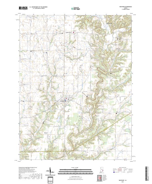
Westport serves as the central hub of this Indiana landscape, situated at the confluence of several local routes and waterways. The town's grid, including W Main St and S West St, is surrounded by a dense network of family and community cemeteries that speak to the long-standing agricultural roots of the area. Notable sites like Old Westport Cem and Mount Aerie Cem are scattered across the terrain, alongside smaller settlements such as Letts, Gaynorsville, and the aptly named Letts Corner.
Find a feature on this map
78 named features on this map. Tap any name to fly to it.
Don’t see what you’re looking for? This feature index may not catch every label — zoom into the map to look around manually.
Map Details
Editions of this 2022 Westport Map
This is the sole edition of this map. No revisions or reprints were ever made.