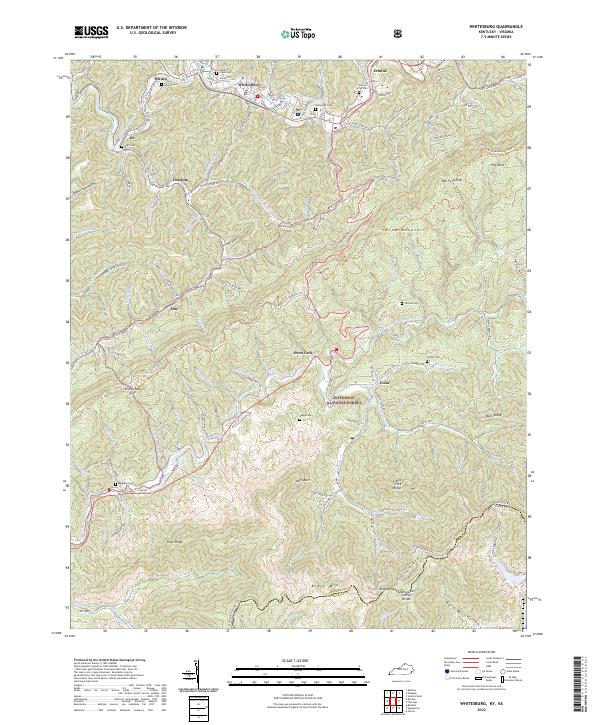
2022 Map of Whitesburg
USGS Topo · Published 2022About this map
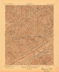
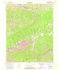
Whitesburg sits along the North Fork Kentucky River, serving as a focal point for this mountain landscape where the Tennessee Valley Divide and the border with Virginia meet. The terrain is characterized by steep ridges and narrow hollows like Poplar Log Hollow and Band Mill Hollow, with settlements such as Eolia, Oven Fork, and Dongola tucked into the valleys. This geography has historically dictated the placement of small family burial grounds and community landmarks, including Evergreen Cem and Sandlick Creek Cem.
Find a feature on this map
132 named features on this map. Tap any name to fly to it.
Don’t see what you’re looking for? This feature index may not catch every label — zoom into the map to look around manually.
Map Details
Editions of this 2022 Whitesburg Map
This is the sole edition of this map. No revisions or reprints were ever made.
Historical Maps of Ermine Through Time
3 maps found