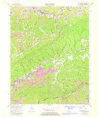
1954 Map of Whitesburg
USGS Topo · Published 1978About this map
Whitesburg sits at the junction of the Kentucky River and its North Fork during this mid-century period. The landscape is defined by the heavy presence of industry and infrastructure, with several labeled Strip Mines and the Louisville and Nashville railroad tracks following the river valley through Whitco and Ermine. Local life in Letcher County is anchored by a network of small community institutions like the Middle Cowan Creek Sch and the Big Cowan Ch, while the southern reaches of the map show the transition toward Pine Mountain and the Kentucky Virginia border.
Find a feature on this map
78 named features on this map. Tap any name to fly to it.
Don’t see what you’re looking for? This feature index may not catch every label — zoom into the map to look around manually.
Map Details
Editions of this 1954 Whitesburg Map
4 editions found
Other maps of this area

1890 · Whitesburg
USGS Topo · 1:125,000

1892 · Whitesburg
USGS Topo · 1:125,000

1894 · Estillville
USGS Topo · 1:125,000

1912 · Pound
USGS Topo · 1:48,000

1913 · Oven Fork
USGS Topo · 1:48,000

1914 · Pound
USGS Topo · 1:62,500

1915 · Whitesburg
USGS Topo · 1:62,500

1920 · Wise
USGS Topo · 1:48,000

1921 · Big Stone Gap
USGS Topo · 1:48,000

1921 · Wise
USGS Topo · 1:62,500