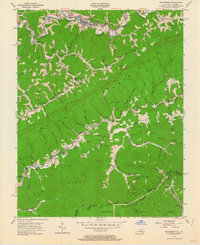
1954 Map of Whitesburg
USGS Topo · Published 1964About this map
The North Fork Kentucky River meanders through the northern edge of this coal-country landscape, serving as the industrial anchor for the Louisville and Nashville railroad and the county seat of Whitesburg. This 1954 survey captures the region during a peak period of topographic change, where traditional mountain settlements like Oven Fork and Whitco coexist with active Strip Mines. The high ridgelines of Pine Mountain and Black Mountain dominate the terrain, creating a network of deep hollows where family-named landmarks like Halls Butt and Parsons Cem were established. Local life is anchored by a series of small, distributed educational and spiritual centers, including the Middle Cowan Creek Sch and Big Cowan Ch. In the southern reaches, the Poor Fork Cumberland River marks the watershed divide near the Kentucky Virginia border, where the Jefferson National Forest provides a buffer against the intensive resource extraction visible on the neighboring slopes.
Find a feature on this map
68 named features on this map. Tap any name to fly to it.
Don’t see what you’re looking for? This feature index may not catch every label — zoom into the map to look around manually.
Map Details
Editions of this 1954 Whitesburg Map
4 editions found
Other maps of this area

1890 · Whitesburg
USGS Topo · 1:125,000

1892 · Whitesburg
USGS Topo · 1:125,000

1894 · Estillville
USGS Topo · 1:125,000

1912 · Pound
USGS Topo · 1:48,000

1913 · Oven Fork
USGS Topo · 1:48,000

1914 · Pound
USGS Topo · 1:62,500

1915 · Whitesburg
USGS Topo · 1:62,500

1920 · Wise
USGS Topo · 1:48,000

1921 · Big Stone Gap
USGS Topo · 1:48,000

1921 · Wise
USGS Topo · 1:62,500