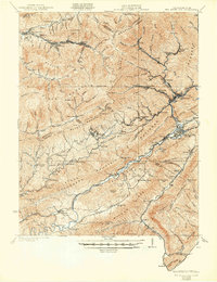
1921 Map of Big Stone Gap
USGS Topo · Published 1921About this map
The Powell River cuts through the heavy ridges of the Cumberland Mountains, anchoring a landscape defined by the early twentieth-century coal and timber economy. In this 1920 survey, the Southern RR and local spurs connect a series of industrial company towns and settlements, including Stonega, Arno, Inman, and Keokee. The map documents a dense network of family-named landmarks and essential rural institutions, such as Robbins Chapel, the Seminary School, and Johnsons Mill PO. These points of interest are situated between the steep elevations of Stone Mountain and Black Mountain, where the border between Kentucky and Virginia follows the highest peaks. The intricate drainage patterns of Roaring Fork and Callahan Creek highlight the difficult terrain that dictated the placement of rail lines and early road crossings like DeBusk Ford.
Find a feature on this map
96 named features on this map. Tap any name to fly to it.
Don’t see what you’re looking for? This feature index may not catch every label — zoom into the map to look around manually.
Map Details
Editions of this 1921 Big Stone Gap Map
This is the sole edition of this map. No revisions or reprints were ever made.
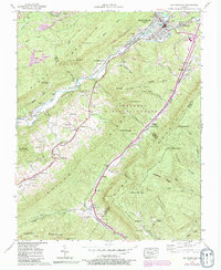
Historical Maps of Big Stone Gap Through Time
6 maps found